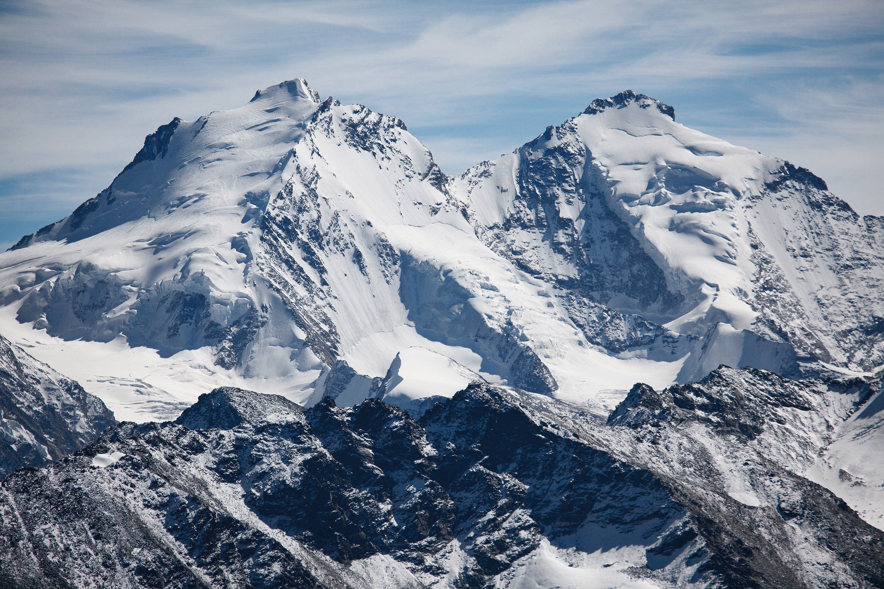
Die Bella Tola ist ein einfacher und freistehender 3000er mit einer beeindruckenden Rundumsicht auf die Walliser und Berner Alpen.
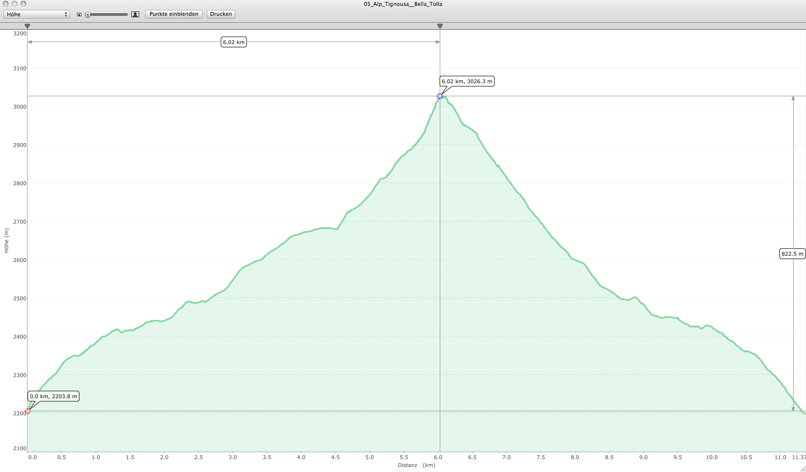
Der Weg ist durchgängig gut markiert und einfach begehbar. Im ersten Abschnitt wandert man über Wiesen, später folgt man einem Fahrweg (Skigebiet) zum Fuß des Berges. Von dort geht es weiter in Serpentinen zum Verbindungsgrat Rothorn – Bella Tola. Der Schlussanstieg auf den Gipfel führt dann über Geröllfelder. Einer der leichtesten Dreitausender im Wallis – alles durchgängig einfaches Gehgelände, dafür aber mit einer aussergewöhnlich genialen Aussicht.
Bei maximaler Sicht blickt man auf 663 Schweizer Gipfel, davon 378 über 3000 m und 30 über 4000 m*. Sollte noch ausreichend Zeit vorhanden sein, lohnt sich auch ein Abstecher zum gegenüberliegenden und wenig niedrigerem Rothorn (2998 m).
Ausgangspunkt:
Von Saint Luc (VS) mit der Zahnradbahn zur Alp Tignousa.